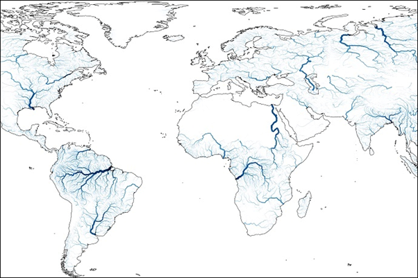
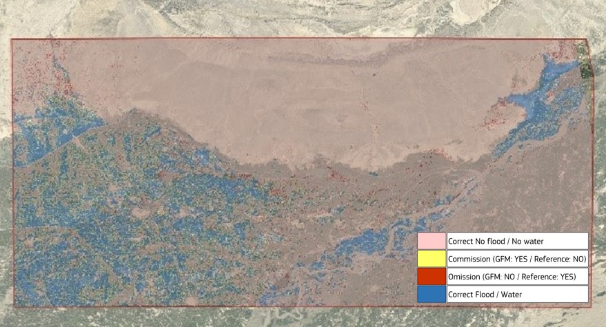
The Global Flood Monitoring (GFM) product of the Copernicus Emergency Management Service provides a continuous monitoring of flood events worldwide, by processing and analysing in near real-time all incoming Sentinel-1 Synthetic Aperture Radar (SAR) satellite imagery.
The GFM - Annual Product and Service Quality Assessment Report 2022, which was recently published as a JRC Technical Report, presents the results of the quarterly monitoring and reporting of the following key aspects of the GFM product performance:
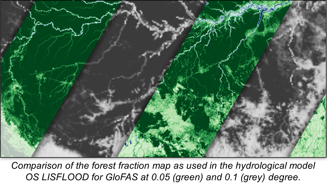
The pre-release of the Copernicus Emergency Management Service (CEMS) Global Flood Awareness System (GloFAS) version 4.0 is now available on the GloFAS stage platform.
This upgrade has large impacts on the GloFAS modelling results.
GloFAS 4.0: what’s new
GloFAS v4.0 introduces several major improvements to the system, including:
Thank you for providing feedback on GloFAS and GFM!
Your responses will help us to improve the products and service.
Please click here to read the results of the survey, as well as the planned follow-up actions.
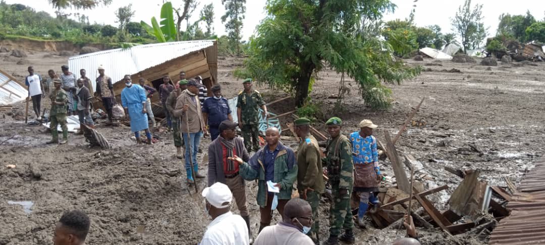
Rwanda and Democratic Republic of the Congo, May 2023
Heavy rainfall, floods, mudslides and landslides resulted in significant loss of life, displacement of families and widespread damage to infrastructure in Rwanda and eastern areas of the Democratic Republic of the Congo in early May 2023.
Rwanda
Floods and landslides occurred in the Western, Northern and Southern provinces of Rwanda following heavy rainfall in early May 2023.
In a statement of 03 May, the President of the Republic of Rwanda, Paul Kagame, expressed his solidarity with those affected and wounded, as well as his deepest condolences to the families of …
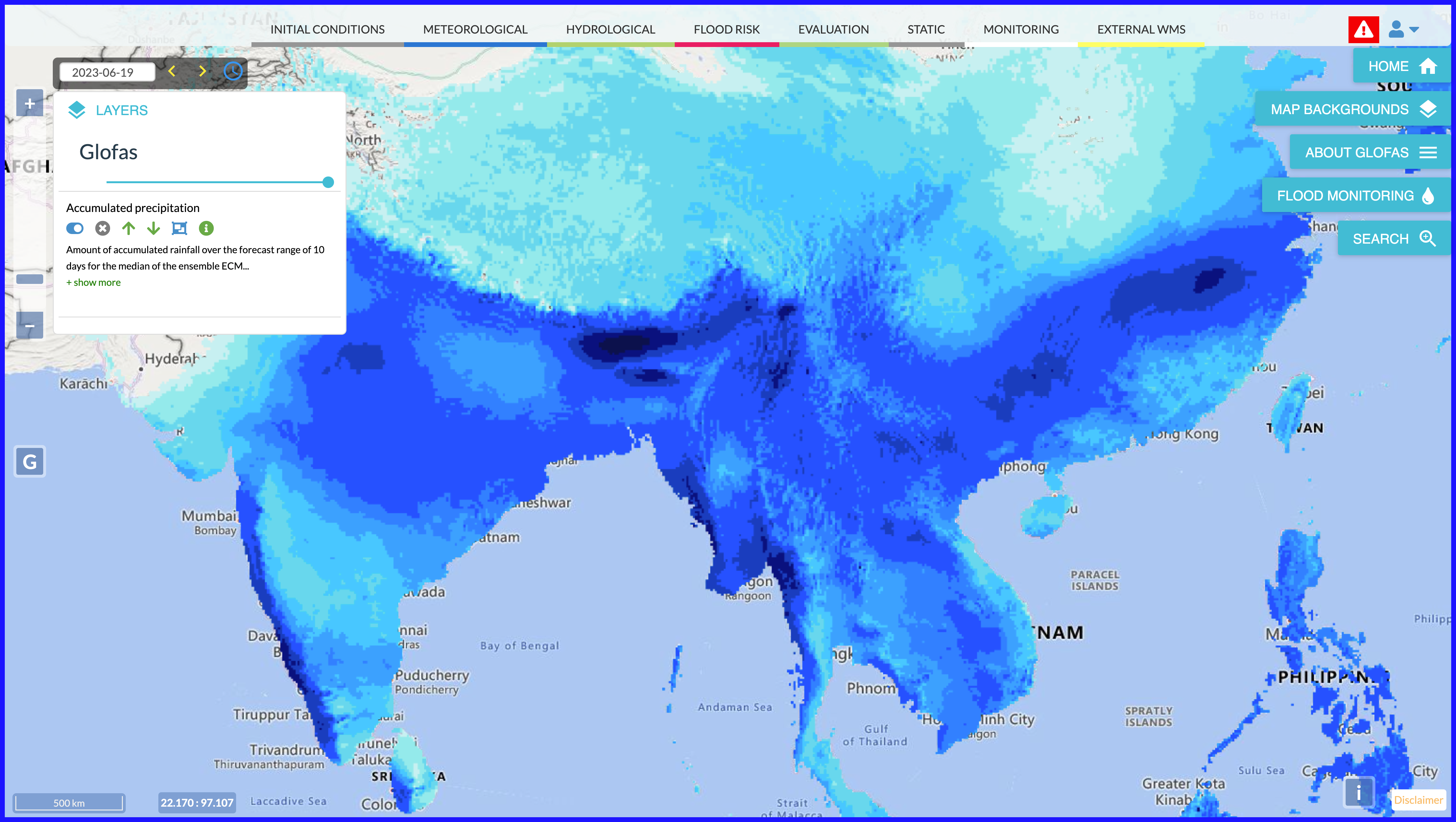
A minor release of the Copernicus Emergency Management Service (CEMS) Global Flood Awareness System (GloFAS), version 3.5, will be launched operationally on Wednesday 28 June 2023.
CEMS GloFAS v3.5 integrates changes in its Numerical Weather Prediction Forcing, with the use of ECMWF ensemble forecasting system version 48R1. The 48R1 ENS has a spatial resolution of 9km compared with 18km for previous ENS versions. The configuration of the NWP input to CEMS GloFAS remains unchanged. More details on the changes can be found in Implementation of IFS Cycle 48r1. The minor release also includes the addition of new reporting …
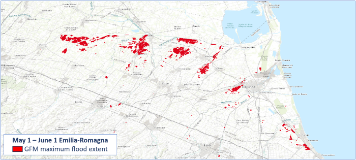
On June 6 2023 a new feature of the CEMS Global Flood Monitoring (GFM) has been released allowing users to generate the maximum flood extent. This novel feature allows users to download, for each AOI, the automatically-generated composite showing the maximum flood extent of the available observed flood layers within a specific timeframe (for now, the limit is set to two months).
The query can be submitted via both the GFM portal and the REST-APIs, giving the users also the chance to decide whether to retrieve the data as a vector (geojson), a raster (OCG) or in …
Floods in South Florida, USA, April 2023
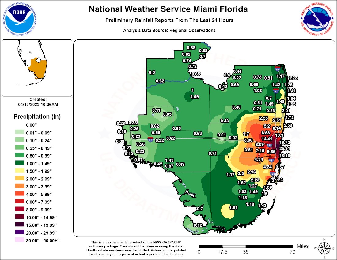
Torrential rain of over 600mm fell in 24 hours in South Florida, USA, triggering severe flooding on 12 and 13 April.
The Mayor of Fort Lauderdale, Dean Trantalis, said the amount of rain was unprecedented and declared a local State of Emergency. The City of Dania Beach also declared a State of Emergency, and officials urged residents to stay off the streets. Broward County closed all public schools in response to the severe weather.
National Weather Service (NWS) Miami said Fort Lauderdale recorded 25.91 inches (658.11 mm) of rain in 24 hours to …
A new version of the GFM (Global Flood Monitoring) product output layer Affected Population, which estimates population potentially impacted by floods, has been released on March 22th 2023.
In this improved GFM product output layer, the affected population is computed for each pixel by combining the observed flood extent detected by the GFM product with the Global Human Settlement Layer (GHSL) data, in particular the GHS-POP dataset, which represents the population's distribution and density as the number of people living within each grid-cell.
In this latest release of the GFM output layer Affected Population, the new GHS-POP dataset at the highest possible resolution (100m) and …
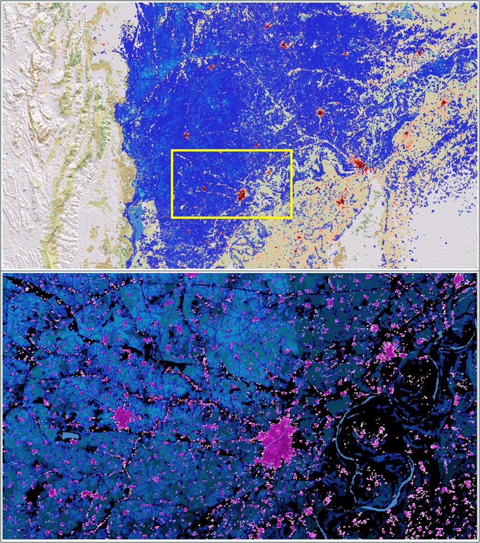
Tropical Cyclone Freddy, South East Africa, March 2023
Tropical Cyclone Freddy made a dramatic second landfall in Mozambique before heading to southern Malawi, causing catastrophic flooding in both countries in March 2023.
Freddy had been a named tropical cyclone for over 30 days before reaching Malawi. The storm had crossed the entire South Indian Ocean and travelled more than 8,000 kilometres, affecting Mauritius and La Réunion on its long journey en route to making landfall in Madagascar on 21 February 2023.
Tropical Cyclone Freddy then spent several days tracking over Mozambique, bringing heavy rains to areas that …
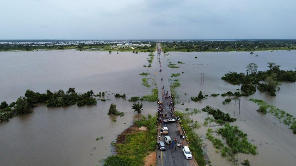
In view of the next major upgrade of the Global Flood Awareness System (GloFAS) of the Copernicus Emergency Management Service (CEMS), a new GloFAS v4.0 hydrological reanalysis dataset has been produced by the Joint Research Center of the European Commission in collaboration with the European Center for Medium-Range Weather Forecast. It enables users to analyse past flood or low-flow events, identify hydrological trends and prepare for the upcoming major release of the operational GloFAS.
The GloFAS v4.0 hydrological reanalysis dataset includes daily maps of discharge (in m3/s) with global extent at 0.05 degree …
